

NERP TE Project 12.2 - Harnessing natural regeneration for cost-effective rainforest restoration (Griffith University, UQ)
Project summary
The project will assist decision-makers to more efficiently restore biodiversity to degraded rainforest landscapes by providing new knowledge about the outcomes of lower-cost natural regeneration (including potential for minimum intervention management) relative to higher-cost active reforestation (replanting). The outcomes of this project will enable planners to assess the costs, risks and benefits of different approaches to reforestation and choose the most appropriate method for any particular ecological and economic context.
Why this research is needed
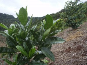
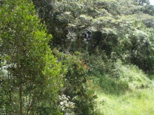
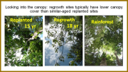
Replanting rainforest is an expensive activity. This project will explore the potential for naturally regenerating forests (regrowth) to provide a much needed lower-cost option to restore critical habitat over large areas.
Research-user focus
Government agencies, conservation groups and community organisations in the Wet Tropics region will use the outcomes of this research to achieve better revegetationoutcomes. Identified research-users include the Wet Tropics Management Authority, Terrain NRM, the Department of Sustainability, Environment, Water, Population and Communities, the Queensland Department of Agriculture, Fisheries and Forestry, Far North Queensland Regional Organisationof Councils, Conservation Volunteers Australia and other non-government community conservation and restoration organisations.
Outcomes
This project will:
- Compare the likely biodiversity and biomass returns over time from investment in active (replanting) and passive (natural regrowth) approaches to rainforest restoration.
- Deliver information about the likely outcomes over time of natural regeneration in different land contexts.
This will help government agencies and landholders to better forecast outcomes resulting from passive regeneration over defined timeframes. This knowledge will also be useful to private enterprises interested in capitalising on emerging carbon markets.
Maps
Expand map viewer to full page.
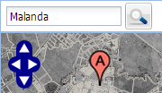
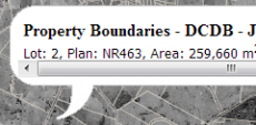
Find areas of regrowth yourself. This map shows the historic aerial imagery of Atherton (1978) over the top of Google satellite imagery.
Map help

Reports, Publications and News
For more information see Project 12.2 'Harnessing natural regeneration for cost-effective rainforest restoration'; on the NERP Tropical Ecosystems Hub site.
Images
Datasets
This data set describes change in forest attributes over time in response to passive regrowth and biodiverse ecological restoration plantings across the southern Atherton uplands. These data were obtained from four sets of spatially replicated site-types: (1) a chronosequence of 29 passive regrowth sites (1-67 years) on previously forested land with a subsequent period of land use for agriculture (e.g.
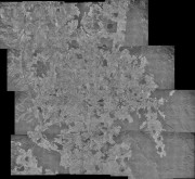
This dataset is a photo mosaic of historic aerial imagery of the southern Atherton Tablelands from 16th June 1978.
It includes the towns of Atherton, Malanda, Yungaburra and Tolga. It has a southern boundary just north of Millaa Millaa, a northern boundary of Lake Tinaroo, an eastern boundary of a quarter of Wooroonooran National Park and a western boundary of Atherton.
The project will assist decision-makers to more efficiently restore biodiversity to degraded rainforest landscapes by providing new knowledge about the outcomes of lower-cost natural regeneration (including potential for minimum intervention management) relative to higher-cost active reforestation (replanting) on post-agricultural land. The outcomes of this project will enable planners to assess the costs, risks and benefits of different approaches to reforestation and choose the most appropriate method for any particular ecological and economic context.