
Recent datasets

The purpose of this study is to quantify spatial and temporal changes in the density of crown-of-thorns starfish and benthic cover in the Great Barrier Reef. Broad-scale manta tow surveys have been conducted by the Long-Term Monitoring Program (LTMP) of the Australian Institiute of Marine Science since 1986, counting crown-of-thorns-starfish (COTS, Acanthaster planci).

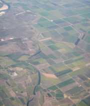
This dataset consists of 31 monitoring sites in the Tully-Ingham area. Sites have various levels of rainforest invasion. Each site has a vegetation strata species list and counts of each species in each strata. Trees with stems > 10cm Diameter Breast Height (DBH) are identified and their DBH and height are measured. Date of survey May-July 2014.
This dataset shows the concentrations of multiple herbicides remaining over time in a simulation flask persistence experiment conducted in 2013. \n \nThe aim of this study was to quantify the persistence multiple herbicides in a standard flask experiment. Time it takes for degradation of half of this herbicide is termed the "half-life". The half-life can be used to help develop environmental risk assessments. \n \n \nMethods: \n \nHerbicide degradation experiments were carried out in flasks according to the OECD methods for "simulation tests".

This dataset shows the geology of the Torres Strait region. The polygons in this dataset are a digital representation of the distribution or extent of geological units within the area. Polygons have a range of attributes including unit name, age, lithological description and an abbreviated symbol for use in labelling the polygons. These have been extracted from the Rock Units Table held in the Department of Natural Resources, Mines and Energy Merlin Database.

This dataset shows the broad geology of the Wet Tropics of Queensland and surrounding areas from Ayr up to north of Cooktown. It is a combination of the "Geology of the Wet Tropics Bioregion (WTMA)" dataset (WtmaGeology) from the Vegetation mapping of the Wet Tropics and the state wide Regional Ecosystem mapping by the Queensland Government.
Benthic organisms were surveyed annually on fixed sites in one habitat on each of 47 selected core survey reefs from 1993 to 2005 in 6 regions throughout the Great Barrier Reef (GBR). Surveys were undertaken at 3 sites per reef, with 5x50m transects surveyed per site. \n \nIn 2004 a new zoning plan was implemented in the Great Barrier reef Marine Park and in 2006 the pattern of surveys was changed. The original set of reefs (47) are surveyed in odd years (e.g. 2007) and a different set (56 reefs) are surveyed in even years.
64 'key' reefs in 11 sectors of the Great Barrier Reef (Cape Grenville, Princess Charlotte Bay, Cooktown/Lizard Island, Cairns, Innisfail, Townsville, Cape Upstart, Whitsunday, Pompey Complex, Swain and Capricorn Bunker) are annually surveyed for crown-of-thorns starfish using the manta tow technique. An additional 117 reefs from the sectors (excluding the Whitsunday, Swain and Capricorn-Bunker sectors) are scheduled for survey every third year ('cycle' reefs).
Data on the general appearance and condition of coral reefs which have been manta towed in the Long Term Monitoring Project (LTMP). The data from 4 reef zones - front (seaward) and back (leeward), and north and south (flanks 1 and 2) - are used to create a web page on each zone for each reef (http://apps.aims.gov.au/reef-monitoring/).
In 6 sectors of the Great Barrier Reef (Cooktown/Lizard island, Cairns, Townsville, Whitsunday, Swain and Capricorn Bunker) 49 of the key manta tow reefs are designated 'core' survey reefs and are also surveyed using the scuba search technique. Where possible, three or more reefs in each sector have been selected in each of three positions across the continental shelf: inshore, mid-shelf and outer shelf. \n \n Results of scuba searches for juvenile Crown-of-Thorns Starfish (COTS), Acanthaster cf. solaris, and the mollusc Drupella.

This data set contains information on Oil and Gas pipeline infrastructure. This dataset has been converted from Microstation format used in a map "Petroleum Exploration and Development Titles" published annually in APRIL. Attributes have been added to comply with data standards and minor coding of line work has been achieved using annotation from the map. Further data has been added, specifically for the specific Acreage Release Areas.
The AIMS Long-term Monitoring Program (LTMP) is designed to detect changes in reef communities at a subregional scale. In this context, a subregion encompasses inshore, mid-shelf and outer shelf reefs across the continental shelf within one band of latitude (a sector). \n \nReef surveys involve three approaches: \n \n1. broadscale manta tow surveys of crown-of-thorns starfish populations and reef-wide coral cover \n2. Intensive photographic surveys of stationary seafloor (benthic) organisms on fixed transects \n3.
Water Quality Data from the AIMS Long Term Monitoring Program. Water and sediments (another dataset) were sampled at the same sites adjacent to all 52 reefs where fish and benthic transects are conducted. Sampling occurs in open water within 500 metres of the reef, on both sides (north and south flanks) of the reef.
As a sub-project of the now discontinued water quality component of the AIMS Long-term Monitoring Project, sediments were examined along cross-shelf transects commencing at the mouths of the Johnstone and Barron Rivers, which drain heavily cultivated areas. Results were compared with sediments from a transect commencing near the Pascoe River, which drains an uncultivated area of Cape York. Observations were made between November 1992 and April 1996. Sampling was conducted in alternate dry and wet seasons 1992-1993 but only in wet (summer) season 1994 and 1995.

This dataset contains polygons depicting vegetation communities of the Wet Tropics Bioregion. Over 250 vegetation types are described using structural and floristic characteristics, and the vegetation communities have been classified using a logical, hierarchical framework.
At a broad level, the vegetation includes the rainforests, forests and woodlands, sclerophyll rainforests, shrublands and heathlands, herblands and mangrove communities distributed throughout the bioregion.

The eAtlas delivers its mapping products via two Web Mapping Services, a legacy server (from 2008-2011) and a newer primary server (2011+) to which all new content it added. This record describes the legacy WMS. This service was decommissioned on in Jan 2024.
The project will assist decision-makers to more efficiently restore biodiversity to degraded rainforest landscapes by providing new knowledge about the outcomes of lower-cost natural regeneration (including potential for minimum intervention management) relative to higher-cost active reforestation (replanting) on post-agricultural land. The outcomes of this project will enable planners to assess the costs, risks and benefits of different approaches to reforestation and choose the most appropriate method for any particular ecological and economic context.

This dataset contains the major roads for Australia, extracted from the OpenStreetMap project on December 2011 by CloudMade.
From the complete set of roads in the OpenStreetMap shapefile only major roads were extracted. This created a smaller high performance shapefile.
In ArcMap loaded the AU_CloudMade_OpenStreetMap-Dec-2011 shapefile then used the Analysis Tools/Extract/Select tool to extract the major roads.
Input Feature Class: australia_highway.shp
Output Feature Class: AU_OSM_MajorRoads.shp
This project involved working with a range of stakeholders to identify the most effective governance systems for managing climate change adaptation in the Wet Tropics through the emergence of new ecosystem service markets, including Carbon Farming. The project will directly contribute to: Regional climate change adaptation policies and planning processes, Regional Natural Resource Management (NRM) organisations’ role in guiding emerging carbon markets in Australia and the region.
This project developed:
This dataset corresponds to the polygon digitisation of tourism sites and sugar mills. The locations of the tourism sites were obtained from a commercial database of tourism operators (Australian Tourism Warehouse). The location of sugar mills was obtained from information gathered on the internet and point locations were created for each mill. These datasets were developed to fill in missing source datasets for the scenario modelling used for the coastal development modelling.

This dataset contains the extent of the coastal zone for the Great Barrier Reef. This extent was identified as the most suitable area to be investigated on land and at sea as part of a conservation planning project looking at coastal development along the GBR coast.
Methods: